- Screen Colours:
- Normal
- Black & Yellow
Genealogist Elizabeth Walne has produced an excellent Suffolk "Parish Map c1850", and another mapping them to "Registration Districts 1837" — see here.
Equivalent tables of Local Government and Registration District changes in all Alde Valley parishes since the 1830's are available via our "Downloads" page.
Links to over one hundred historical maps (including several of Suffolk) are also available here. RECENTLY ADDED
SUFFOLK EARLY 20th CENTURY LOCAL GOVERNMENT
The map below shows the County Borough of Ipswich, the Municipal Boroughs, and the Urban and Rural Districts.
Our Alde Valley area equated at that time to Plomesgate RD and the southern wedge of Blything, with the urban Leiston, Saxmundham and Aldeburgh.
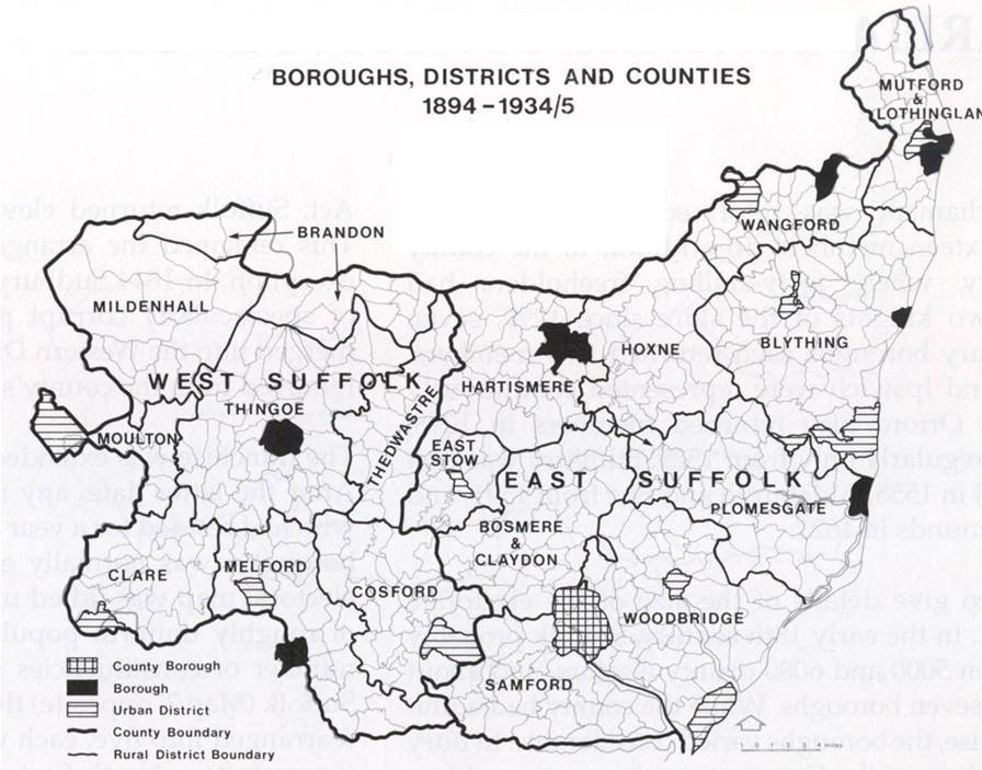
on or near the coast ...
Halesworth UD
Southwold MB
ALDE VALLEY including ...
part of BLYTHING RD
Leiston-cum-Sizewell UD
Saxmundham UD [inland]
Aldeburgh MB
and
PLOMESGATE RD
below: SUFFOLK MAP OF 1910
![County of Suffolk [map showing] the Parliamentary Divisions and Boroughs (1910)](/assets/Maps/MAP-1910-SK-PD-Suffolk1910.jpg)
below: SUFFOLK MAP OF c.1900
1°E 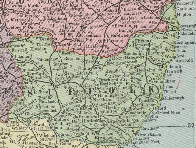
1°E
It is helpful to know that the adjoining edges of Ordnance Survey map squares TL and TM lie close (but not quite parallel) to the 1°E line of longitude, and
that those two lines cut across the common border between the West and East Suffolk County Councils of 1889-1974 at several points, as indicated below.
The closest familiar places to this quite narrow zone are Diss (in Norfolk), Stowmarket, Hadleigh and Dedham (in Essex).
The map below of course just shows parishes in western and central Suffolk, but visit our 'Suffolk Parishes' webpage for eastern Suffolk parishes too.
![County of Suffolk C19th Parish Map [of WSCC with ESCC border, National Grid squares TL/TM & 1°E]](/assets/Maps/1E-TL-TM-WSCC-ESCC-map.jpg)
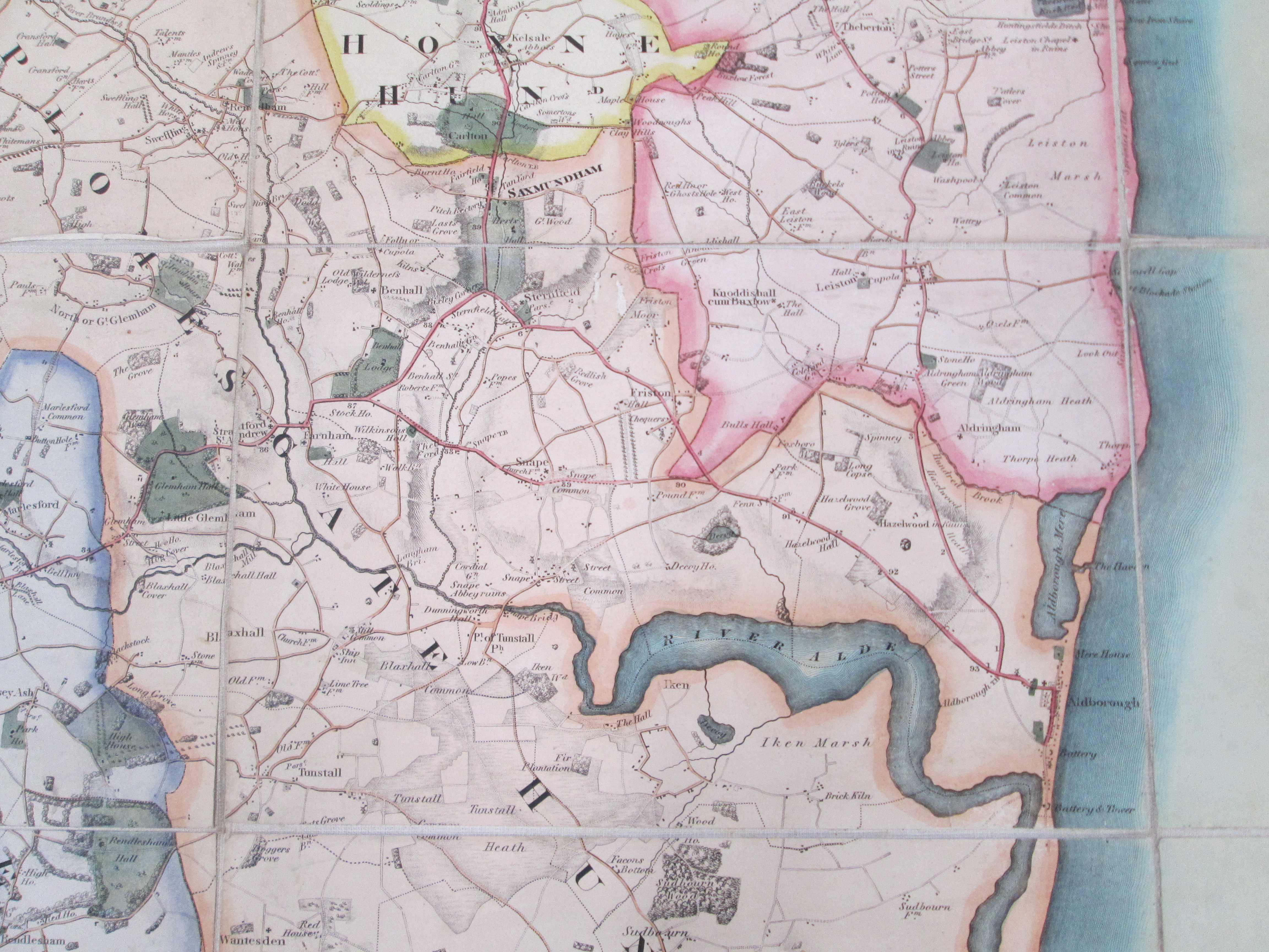
below: RIVER ALDE VALLEY MAP OF 1824/25
Detail from "Map of the County of Suffolk,
from actual survey by A. Bryant in the years 1824 and 1825"
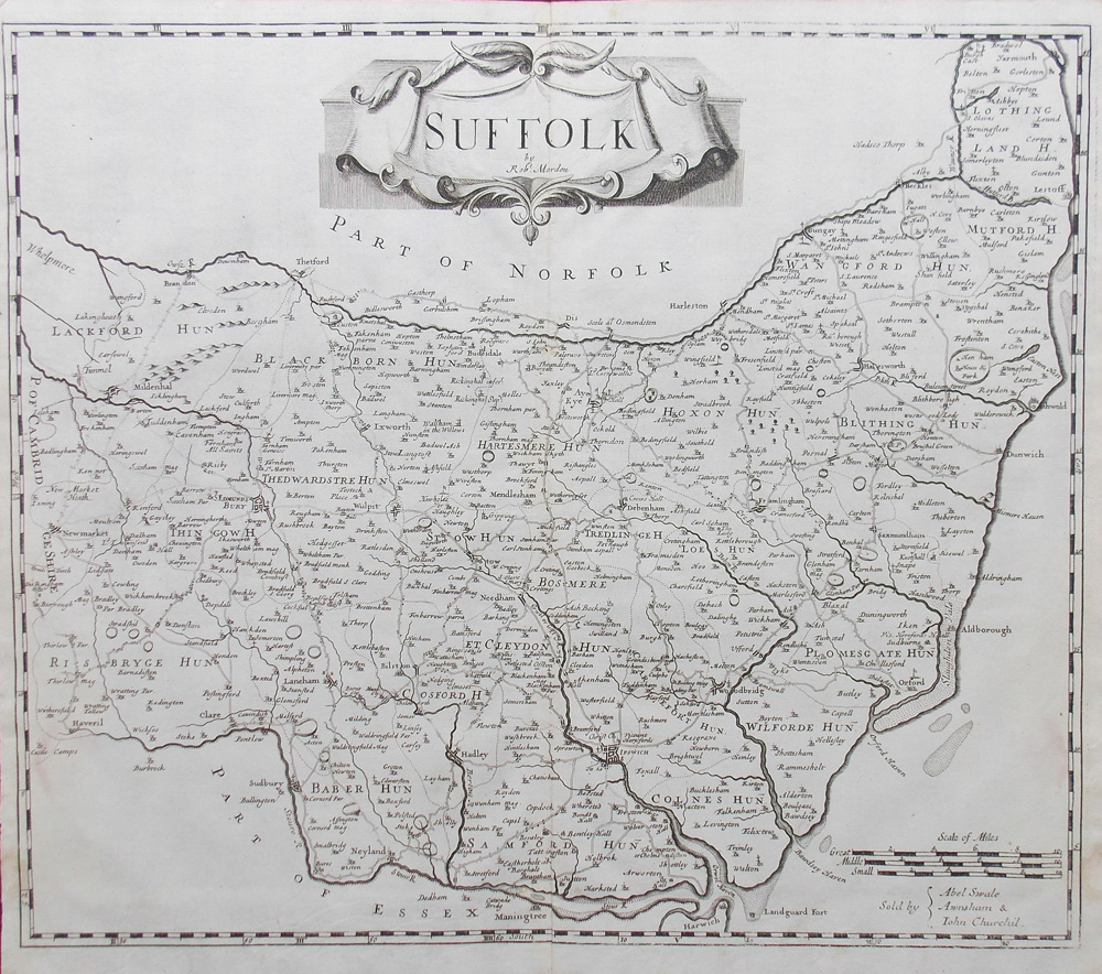
below: SUFFOLK MAP OF c.1720
below: SUFFOLK MAP OF 1578
(part of first-ever national mapping anywhere, financed by Thomas Seckford of Woodbridge)
![Suffolciae Comitatus” Map 1574-8 by Saxton [financed by Woodbridge's Thomas Seckford]](/assets/Maps/MAP1579SK-Suffolciae-Comitatus-by-SaxtonSeckford.jpg)